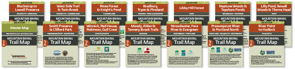
Showcase of work:
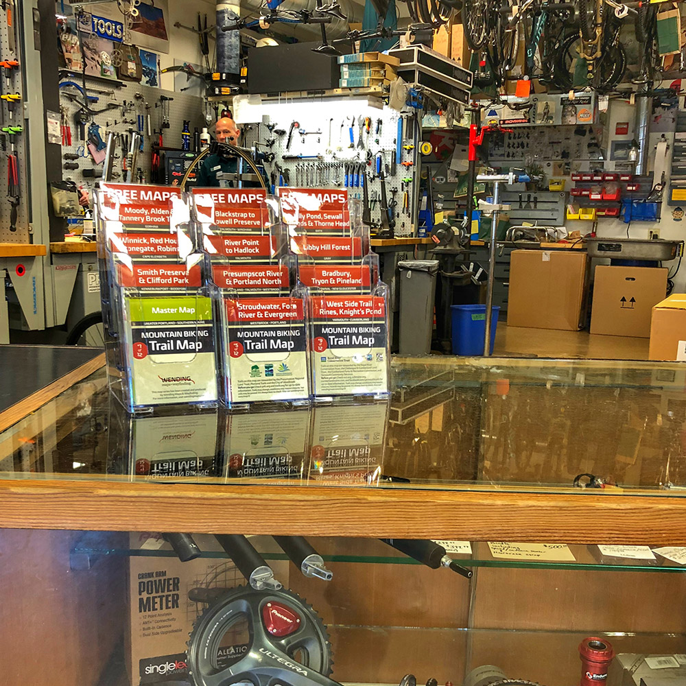
Mountain Bike Map Series Print Maps Interactive Maps Need a Map Created?

Showcase of work:
Mountain Bike Map Series Print Maps Interactive Maps Need a Map Created?
Visit the L.L.Bean Bike, Boat and Ski Store to pick up maps today.
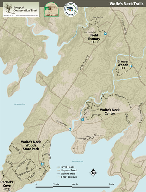
Wolfe’s Neck Trails map with area information on the reverse
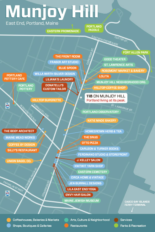
118 on Munjoy Hill locator map and Munjoy Hill retail directory two-sided postcard for area businesses to provide to their patrons, created as part of the 118 on Munjoy Hill project.
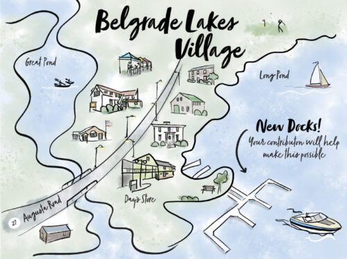
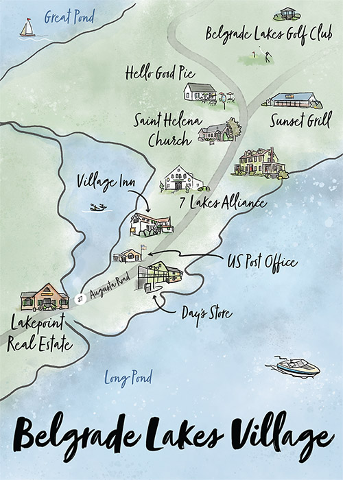 Belgrade Lakes illustrated map flyer used by Hammond Lumber to raise funds for Day’s Store to purchase a new dock. Later adapted and expanded (with Hammond Lumber permission) for use by Lakepoint Real Estate as a 5×7 postcard.
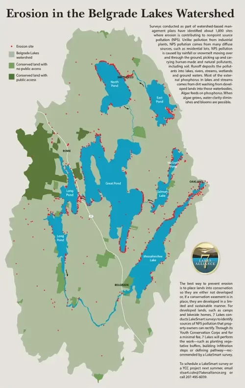
Map showing red points at more than 1,000 erosion points in the Belgrade Lakes watershed, created as part of the materials for 7 Lakes Alliance.
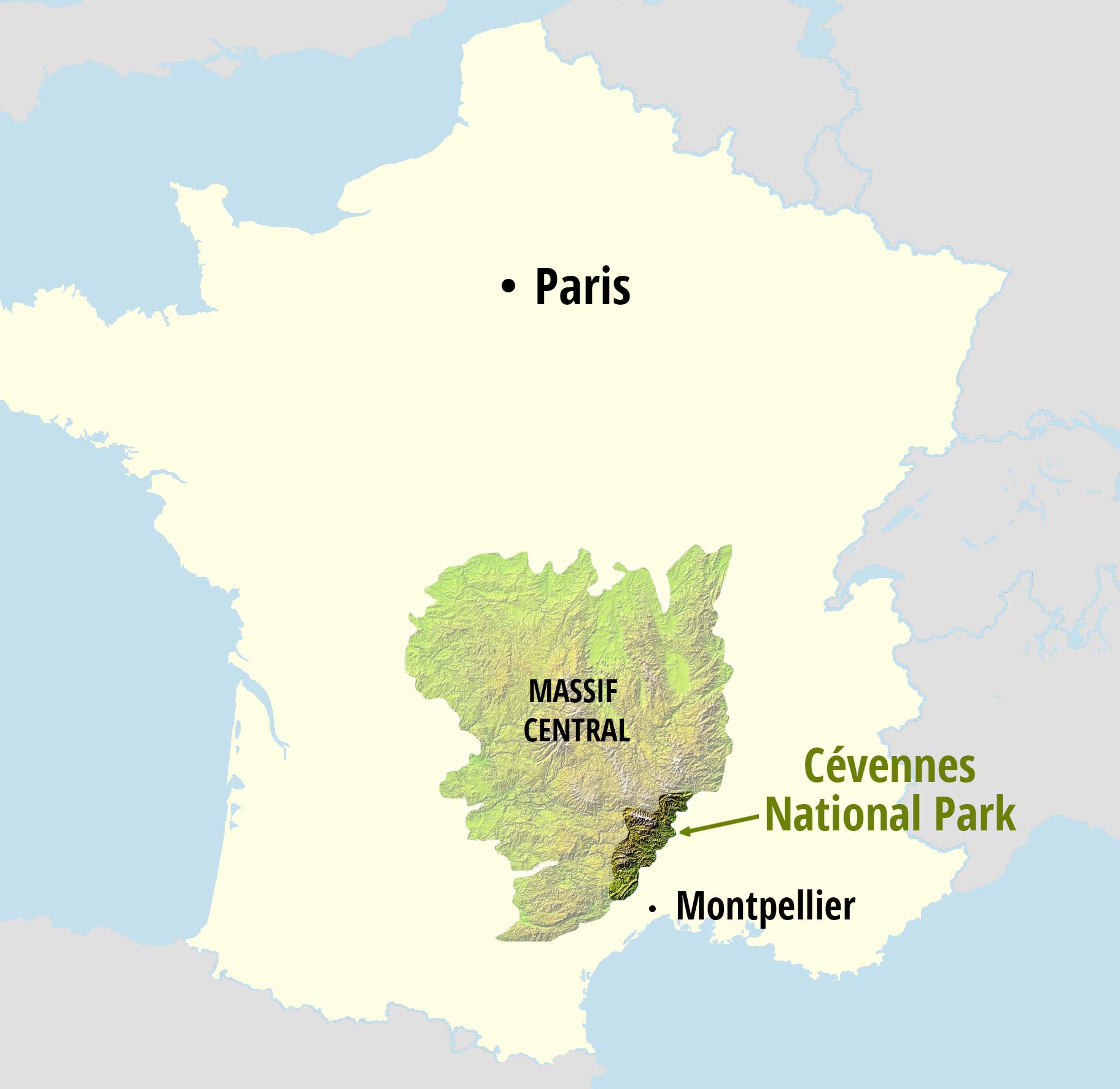
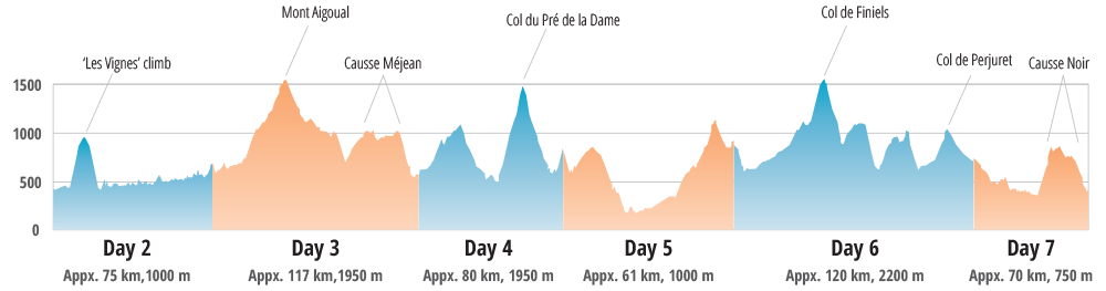
44|5 Cycling locator map for their Cevennes page and elevation profiles for each of 9 highroad tours
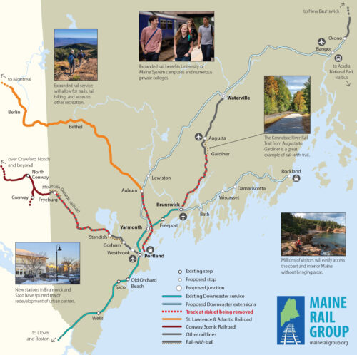
A map of southern Maine railroads, to illustrate at-risk segments on Maine Rail Group’s flyer.
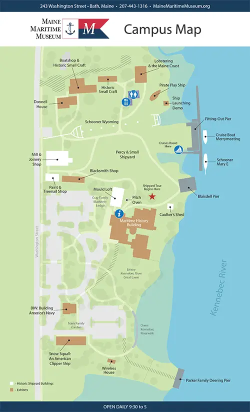
Map of the Maine Maritime Museum campus with location descriptions on the reverse.
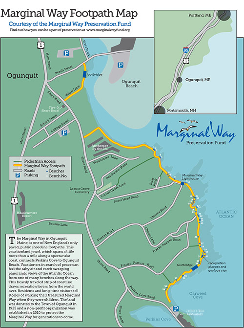
The Marginal Way Footpath map with numbered memorial benches and other markers, created as part of the Marginal Way Preservation Fund project.
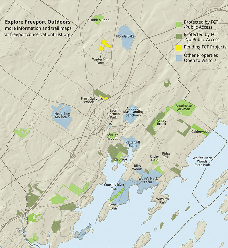
Freeport Conservation Trust map of trail areas for use on the website, in an oversized tri-fold mailer, created as part of the Freeport Conservation Trust project.
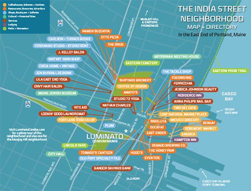
India Street retail directory two-sided postcard for area busineses to provide to their patrons, and also for use in the brochure booklet, created as a part of the Luminato project.
![]()
![]()
Maine Audubon Acadia National Park and Katahdin Woods and Waters National Monument birding maps for spreads in the fall 2022 edition of Habitat magazine.
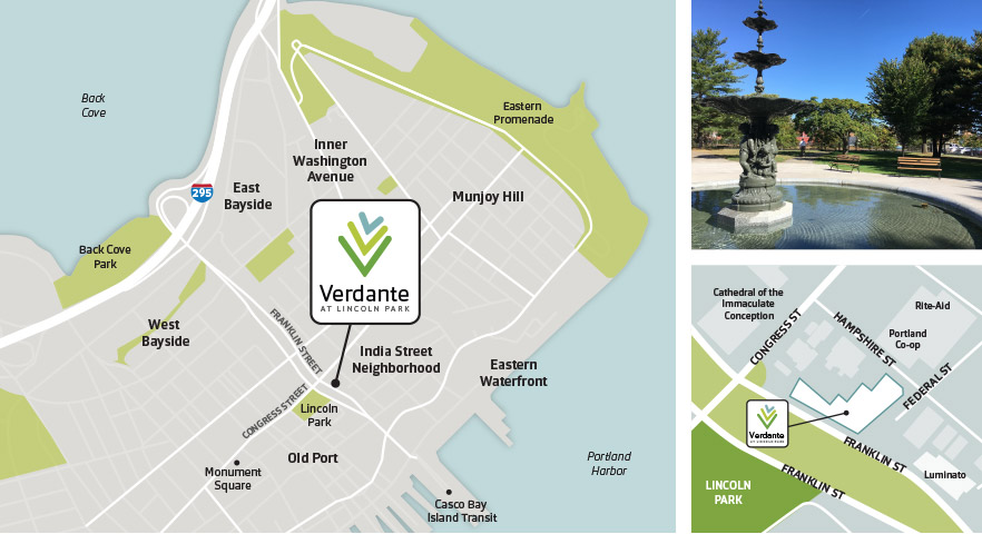
Verdante locator maps for use on the website, quad-fold mailers and in sales folders, created as part of the Verdante project.
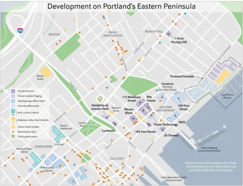
Map showing development on the Eastern Peninsula as of March 2019.
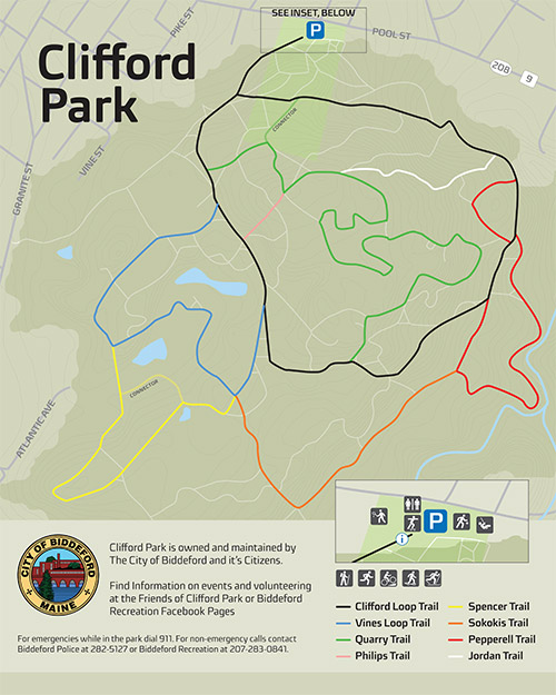
Clifford Park trail map for Biddeford Recreation Commission trail signage.
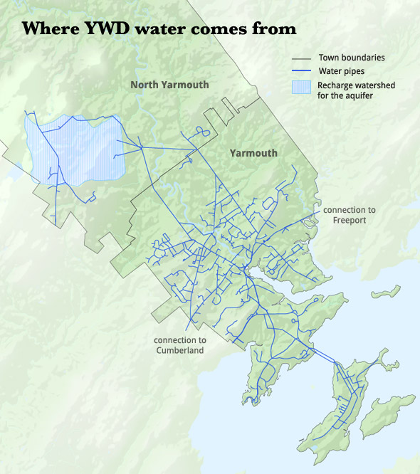
Yarmouth Water District map showing source and water pipes—created as part of the website redesign project.
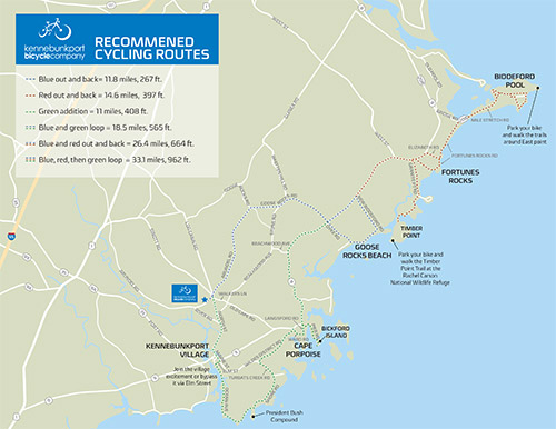
Suggested-routes map for the Kennebunkport Bicycle Company to provide to bicycle renters.
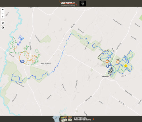
Mapbox Mountain Bike Map 11 demo with info/photo/video popups
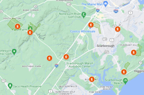
Scarborough Land Trust Google Map as seen on the homepage
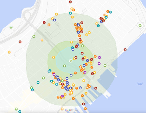
Verdante Google Map as Seen on the location page
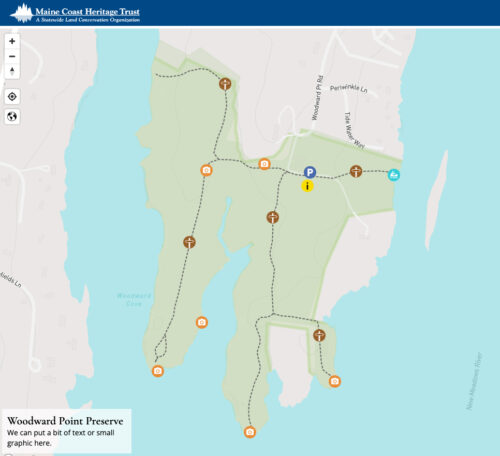
Mapbox Maine Coast Heritage Trust Woodward Preserve demo with info/photo/video popups
Visit Wendy Clark Design for help with

